


UNION TWP Voting District, Marion County, Iowa
About
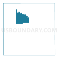
Outline

Summary
| Unique Area Identifier | 582792 |
| Name | UNION TWP Voting District |
| County | Marion County |
| State | Iowa |
| Area (square miles) | 24.78 |
| Land Area (square miles) | 23.10 |
| Water Area (square miles) | 1.68 |
| % of Land Area | 93.23 |
| % of Water Area | 6.77 |
| Latitude of the Internal Point | 41.40570870 |
| Longtitude of the Internal Point | -93.16248690 |
Maps


Graphs
Select a template below for downloading or customizing gragh for UNION TWP Voting District, Marion County, Iowa


Neighbors
Neighoring Voting District (by Name) Neighboring Voting District on the Map
- KNOXVILLE TWP Voting District, Marion County, IA
- PLEASANT GROVE TWP Voting District, Marion County, IA
- RED ROCK TWP Voting District, Marion County, IA
- SUMMIT TWP Voting District, Marion County, IA
Top 10 Neighboring County Subdivision (by Population) Neighboring County Subdivision on the Map
- Knoxville township, Marion County, IA (10,373)
- Pleasant Grove township, Marion County, IA (2,769)
- Summit township, Marion County, IA (1,444)
- Red Rock township, Marion County, IA (596)
- Union township, Marion County, IA (388)
Top 10 Neighboring Unified School District (by Population) Neighboring Unified School District on the Map
- Knoxville Community School District, IA (11,461)
- PCM Community School District, IA (5,681)
- Pleasantville Community School District, IA (3,427)
Top 10 Neighboring State Legislative District Lower Chamber (by Population) Neighboring State Legislative District Lower Chamber on the Map
Top 10 Neighboring State Legislative District Upper Chamber (by Population) Neighboring State Legislative District Upper Chamber on the Map
Top 10 Neighboring 111th Congressional District (by Population) Neighboring 111th Congressional District on the Map
Top 10 Neighboring Census Tract (by Population) Neighboring Census Tract on the Map
- Census Tract 301, Marion County, IA (7,311)
- Census Tract 304.01, Marion County, IA (4,586)
- Census Tract 304.02, Marion County, IA (3,941)